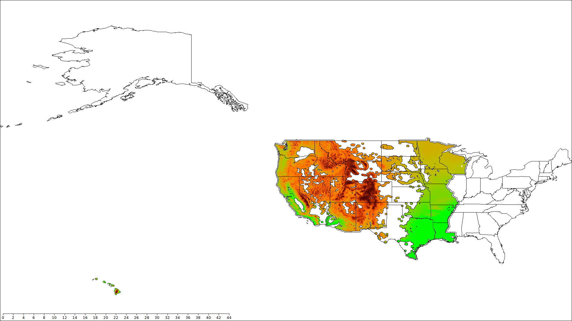
Phase 1 of the project is nearing completion. What is phase 1??
Well phase 1 is the generation and preliminary processing of a 5 acre grid for all forested lands west of the Mississippi River. For the contiguous United States this has nearly been completed. See picture below…
What is Phase 2?
This should be refining of the site grid. but too many people need the raw data too fast. So Phase 2 will be preliminary distribution. We have looked in to this and found several problems. This FREE product has not been free to create and will not be free to house the data for distribution. The initial attempts to house more than 16gb of data were thwarted when the hosting company’s servers began to crash. So plan B. If your organization contacts the Natural Biometrician arrangements can be made to have media delivered to you. This data will only be the climate and topography data.
Phase 3?
Calibration. Out of the box there seem to be some limitations to the “pre-calibrated” site model that had been provided. The dialogs do not suggest any need for additional data for the model to run. The calibration of the grid is the next step. To do this the FIA data from the USFS will be used in an attempt to generate a national “soil/site” equation. Standard base 50 site will be used to calibrate the grid. While there seem to be other methods such as 10 meter site proposed by the Forest Biometrics Research Institute. Many of these methods have not been peer reviewed or widely proven to work.